

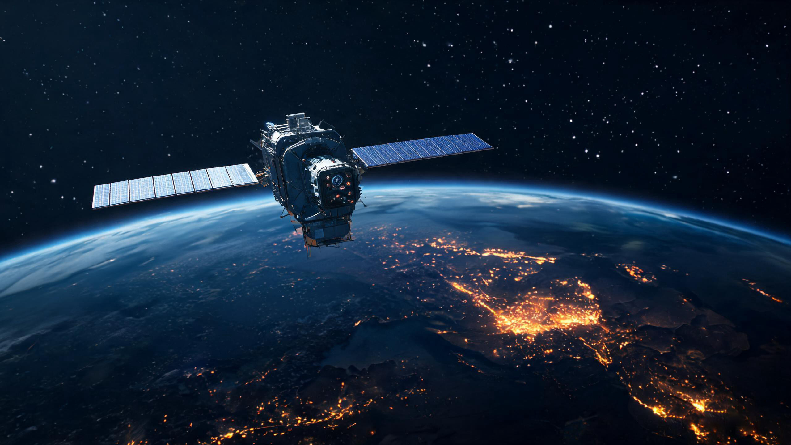
Thermal imaging satellite technology has just crossed from experimental demonstration to full operational reality. UK-based SatVu has released the first light imagery from HotSat-2, the second satellite in its commercial high-resolution thermal imaging constellation, which launched aboard a SpaceX Transporter rideshare mission in late March 2026. Built by Surrey Satellite Technology Ltd., HotSat-2 delivers 3.5-meter resolution thermal imagery — a dramatic leap from the 100-meter resolution currently available through public sources like Landsat. While this breakthrough creates extraordinary value for sanctions monitoring, energy security, and commodity trading, it has also intensified the global debate over who should control access to thermal intelligence, and what boundaries should govern its use.
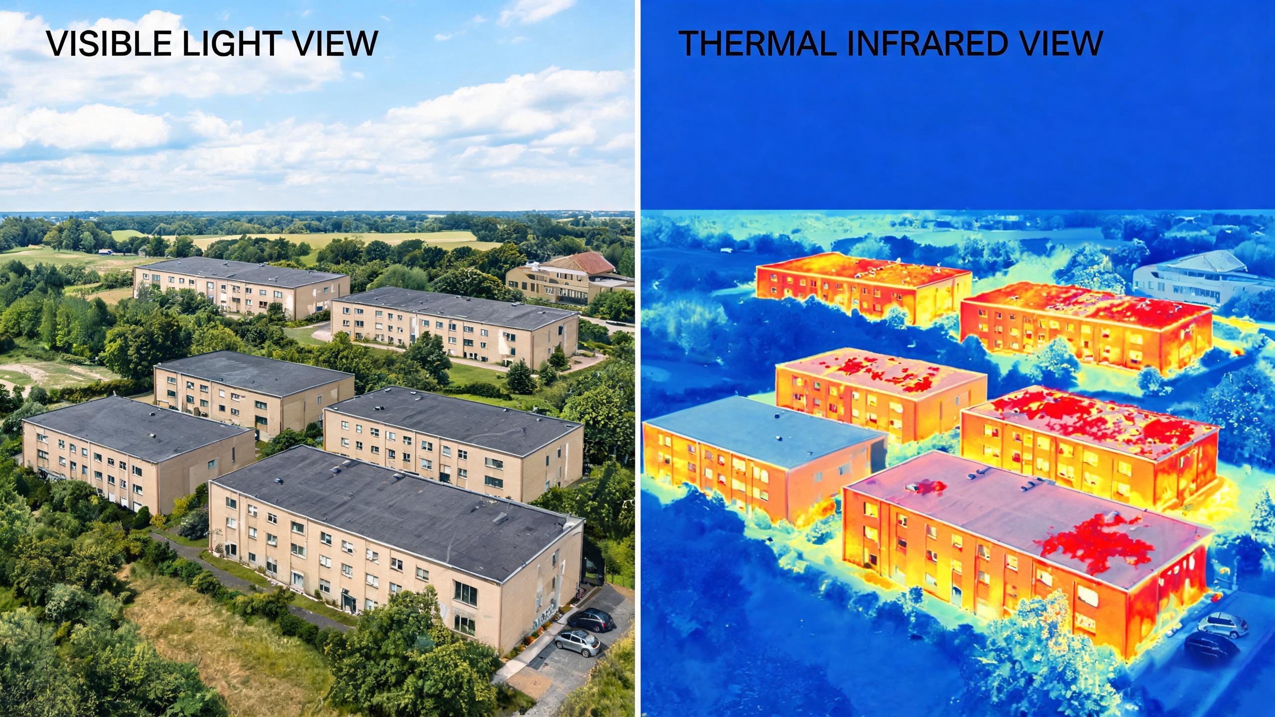
Unlike conventional optical satellites and synthetic aperture radar (SAR), thermal imaging satellites detect infrared radiation emitted by objects based on their temperature. This means they capture heat signatures that remain completely invisible to other sensors — through darkness, smoke, and even building envelopes — revealing operational activity that no other commercial technology can verify.
The Technology Behind HotSat-2
SatVu was founded in 2016 by Anthony Baker and Tobias Reinicke in London to provide thermal data that reveals the utilization and operational status of critical facilities. The company's first pathfinder satellite, HotSat-1, launched aboard a SpaceX Falcon 9 in June 2023 but failed six months after launch — a setback that underscored the engineering challenges of operating high-resolution thermal sensors in orbit. Undeterred, SatVu pressed forward with HotSat-2, built by Surrey Satellite Technology Ltd. and launched via a SpaceX Transporter rideshare mission in late March 2026.
The company's momentum has attracted significant institutional backing. In February 2026, SatVu closed a £30 million funding round led by the NATO Innovation Fund, bringing total equity funding to £60 million. The round drew participation from Lockheed Martin, the British Business Bank, Space Frontiers Fund II, Molten Ventures, Seraphim Space Fund, and others — a powerful signal that sovereign defence and economic security stakeholders see thermal intelligence as strategically essential.
3.5m Resolution
Up to 28x sharper than Landsat's 100m thermal imagery
Day & Night Operation
Captures heat data 24/7 regardless of lighting conditions
Video Capability
Up to 60-second thermal video clips for motion tracking
Activity Intelligence
Detects operational changes inside and around buildings
Where HotSat-1 demonstrated what high-resolution thermal imagery from space could do, HotSat-2 delivers it operationally — at a resolution, frequency, and reliability that commercial customers can act on. As SatVu CTO Scott Herman stated: "Thermal infrared shows what other sensors miss. Daytime and nighttime high-resolution thermal imagery from space delivers unprecedented insight into operational activities at facilities anywhere in the world." This capability creates what SatVu calls "Activity Intelligence" — a new data layer that confirms what is running, when, and at what intensity. On or off. Hot or not.
First Light: Real Evidence from Orbit
On May 7, 2026, SatVu released the first operational imagery from HotSat-2 — and the results immediately demonstrated why this technology is generating both excitement and anxiety. The satellite captured activity at three strategically significant energy sites across three different geopolitical contexts, delivering independent verification of operational status in jurisdictions that are otherwise difficult to monitor.
Cuba — Sanctions Evasion Detected Before Public Acknowledgment
On April 25, 2026, HotSat-2 imaged the Hermanos Díaz refinery in Santiago de Cuba. Two days later, the Cuban government publicly announced that the facility had restarted refining of domestic crude amid tightening U.S. sanctions. The thermal data captured the refinery's operational heat signatures 48 hours before any public acknowledgment — establishing thermal intelligence not merely as supplementary insight, but as an early, objective signal in environments where ground truth is limited or deliberately delayed.
As SatVu CTO Scott Herman noted: "The Cuba image — captured before public acknowledgment of the refinery's restart — illustrates exactly what thermal intelligence makes possible: independent verification of activity in places that are otherwise difficult to monitor."
India — World's Largest Refinery Running Below Capacity
HotSat-2 imaged the Reliance Industries Jamnagar Refinery in Gujarat, India on April 26, 2026 — the world's largest oil refinery. The thermal imagery revealed the facility was not running at full capacity, providing commodity traders, energy operators, and intelligence agencies with independent data on production levels during the current energy crisis and Strait of Hormuz disruption. For markets where accurate capacity utilization data is worth billions, this represents a transformative new information source.
Australia — LNG Production Cadence at Night
The Chevron-operated Gorgon LNG project on Barrow Island, Western Australia — one of the world's largest natural gas developments, jointly operated by Chevron, ExxonMobil, and Shell — was imaged at night. The thermal data revealed the facility was running at approximately 50% operational capacity, providing a precise production cadence reading that would be impossible to obtain through conventional electro-optical or SAR satellite systems after dark.
CEO Anthony Baker summarized the strategic significance: "These images show what independent thermal data delivers in the markets that need it most — sanctions monitoring, energy security, and the operational state of the assets moving global commodities."
Capabilities That Sparked the Privacy Debate
The controversy surrounding HotSat-2 centers on one alarming question: How much should commercial satellites be allowed to see?
What Other Sensors Cannot Capture
Crucially, this thermal data captures heat signatures that remain invisible to electro-optical and synthetic aperture radar systems. Where the key question is capacity utilization, operational status, or 24-hour activity cycles, thermal intelligence is the only data layer that can deliver a definitive answer. It is the in-situ, time-based activity layer that has always been missing from every analyst's stack.
While thermal imaging cannot literally see through solid walls like X-rays, it detects heat escaping through roofs, windows, and ventilation systems. This thermal leakage can reveal:
- Which rooms in a building are occupied and when
- Industrial processes happening inside factories
- Energy usage patterns that indicate activity type
- Equipment operating status in sensitive facilities
For industries already using thermal imaging cameras for building inspection and energy auditing, this satellite-based capability represents a massive scaling of familiar technology. But when the same technology moves from a handheld device operated on private property to an orbital platform capturing entire nations, the ethical and legal implications multiply exponentially.
Beyond Energy: The Full Scope of Activity Intelligence
SatVu's thermal data extends far beyond oil refineries and LNG plants. The same 3.5-meter resolution infrared capability can track blast furnace output, cement production, and data centre performance. It detects flaring intensity and shutdowns in oil and gas operations, monitors power generation patterns including solar farms, and assesses infrastructure resilience across contested environments.
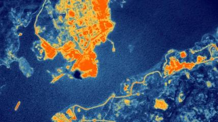
Fig 1: Satellite thermal surveillance can monitor industrial facilities at sub-plant level detail, tracking operational status remotely.
| Application Area | What Thermal Satellites Can Detect | Privacy / Security Concern |
|---|---|---|
| Nuclear Facilities | Reactor operating status, cooling system efficiency, heat dissipation patterns | Exposes operational details of sensitive infrastructure to any paying customer |
| Military Bases | Vehicle activity, building occupancy, energy consumption patterns, ship movements | Commercial intelligence gathering on military installations becomes accessible globally |
| Refineries & Energy | Production levels, flare activity, equipment malfunction, storage fill rates | Proprietary industrial data exposed to competitors and commodity traders |
| Data Centres & Cement | Server load heat signatures, cement kiln output, blast furnace status | Corporate operational secrets revealed to market competitors |
| Residential Areas | Occupancy patterns, energy usage, home activity levels | Personal privacy erosion at unprecedented scale |
The satellite's ability to capture thermal video clips up to 60 seconds long adds another dimension to the debate. Unlike static images, video enables tracking of movement patterns — vehicles leaving military installations, ships maneuvering in naval ports, or changes in industrial workflow over time.
The Global Privacy and Sovereignty Debate
As commercial thermal satellite capabilities advance, regulators in Europe and the United States face mounting pressure to establish clear boundaries. The stakes are particularly high given SatVu's investor base: with the NATO Innovation Fund leading the £30 million round and Lockheed Martin among the participants, the line between commercial earth observation and sovereign defence intelligence is blurring rapidly.
Trisha Saxena, Senior Associate at the NATO Innovation Fund, made the strategic intent explicit: "SatVu's thermal intelligence technology can provide governments and businesses across NATO nations with a level of detailed data that was simply not available before. We are pleased to support SatVu as it revolutionises the earth observation market, delivering critical insights to the security, finance and commodities sectors to help safeguard defence and economic activity across the Alliance."
This framing — thermal data as a strategic asset for allied governments rather than merely a commercial product — raises critical governance questions. Several issues dominate the policy discussion:
Where Is the Privacy Boundary?
Traditional satellite imagery regulations focus on spatial resolution limits for optical photography. But thermal data is fundamentally different — it reveals functional information about what is happening inside structures, not just their external appearance. Current regulatory frameworks were not designed to address this distinction. As allied governments prioritise independent intelligence, thermal earth observation is being positioned as a strategic asset, not just a data source.
Who Should Control Access?
Should high-resolution thermal data of sensitive facilities be available to any commercial customer with sufficient budget? SatVu's constellation roadmap suggests an intentional pivot toward sovereign and defence customers: HotSat-3 is scheduled for launch by the end of 2026, while HotSat-4, HotSat-5, and long-lead elements of HotSat-6 are already under contract. A single satellite can image any location on Earth. A constellation, however, transforms that capability into persistent monitoring — enabling continuous surveillance of mobilisation, operational readiness, and infrastructure status.
Is Informed Consent Possible?
Unlike ground-based surveillance that requires physical proximity, satellite-based thermal surveillance captures data from orbit without any possibility of notification or consent from those being observed. This raises fundamental questions about the right to privacy in an age of ubiquitous overhead monitoring. Anthony Baker, SatVu's CEO and Co-Founder, frames the mission in sovereign terms: "SatVu was founded to give governments access to intelligence they cannot access elsewhere. High-resolution thermal imagery from space reveals activity that is otherwise invisible — day and night — including heat signatures associated with operations inside and around buildings and critical infrastructure."
Industry experts note that the same thermal imaging technology used for legitimate applications — predictive maintenance, climate research, disaster response — can be repurposed for intelligence gathering, corporate espionage, or mass surveillance. The dual-use nature of the technology makes regulatory classification exceptionally challenging.
What This Means for the Thermal Imaging Industry
The HotSat-2 operational milestone arrives at a pivotal moment for the broader thermal imaging sector. As demand for thermal imaging core modules, handheld thermal cameras, and integrated surveillance systems continues to grow across industrial, commercial, and consumer markets, the satellite segment is pushing the technology into entirely new territory.
For businesses and professionals working with terrestrial thermal imaging equipment, the satellite revolution offers both opportunities and cautionary lessons:
- Scalable Insight: Satellite thermal data enables macro-level analysis that complements ground-based thermal imaging cameras — imagine combining satellite heat maps with handheld inspection data for comprehensive facility assessment across blast furnaces, cement kilns, and data centres.
- Regulatory Precedent: How governments regulate commercial thermal satellites will likely influence future restrictions on drone-mounted, vehicle-mounted, and even handheld thermal devices. UK Defence Innovation has already backed SatVu with a Defence Innovation Loan, signalling that sovereign capability development and regulatory frameworks will evolve together.
- Public Perception: As thermal imaging becomes associated with surveillance controversies, transparent communication about legitimate use cases becomes increasingly important for industry participants. The challenge is distinguishing responsible deployment from unchecked monitoring.
- Data Integration: The combination of satellite thermal data with AI analytics is creating unprecedented monitoring capabilities that will reshape industries from commodity trading to insurance risk assessment. Camilla Taylor, SatVu's CFO, confirms the scale of ambition: "This funding secures SatVu's path to execute at scale. We have a clear and credible path to a multi-satellite constellation, accompanied by investors that match the ambition and pace of the business."
At Owlshine, we believe thermal imaging technology should empower professionals to work more safely, efficiently, and sustainably. Whether through a thermal scope for hunting, an industrial inspection camera, or a core module integrated into OEM systems, the fundamental value proposition remains the same: revealing invisible information to enable better decisions. The challenge for the industry is ensuring these capabilities are deployed responsibly — with clear ethical boundaries that protect both security and privacy in equal measure.
Frequently Asked Questions
A: Not in the way X-rays or radar can. Thermal satellites detect heat escaping through roofs, windows, and ventilation, which reveals occupancy and activity patterns inside buildings without showing visual details. The effect is sometimes called "thermal leakage observation" rather than true wall penetration.
A: HotSat-2 delivers approximately 3.5-meter resolution for thermal infrared imagery. By comparison, NASA's Landsat provides about 100-meter thermal resolution, and most commercial alternatives offer 30-meter resolution or worse. This represents roughly a 28x improvement over publicly available alternatives.
A: Currently, yes — there are no universal international laws prohibiting commercial thermal imaging satellite operations. However, individual nations may impose restrictions on data sales, and specific applications (such as targeting military facilities) may violate national security regulations in certain jurisdictions.
A: The core physics are identical — both detect infrared radiation. However, satellite platforms offer massive coverage area and consistent revisit capability, while handheld thermal imaging cameras provide higher resolution at close range and allow operator control over angles and timing. The two approaches complement each other across different scales of application.
A: Key beneficiaries include energy and commodities traders (monitoring refinery activity), climate researchers (urban heat island analysis), insurance assessors (disaster damage evaluation), and national security analysts. The thermal imaging industry as a whole stands to gain from increased awareness and integration of satellite data with terrestrial systems.
Explore Professional Thermal Imaging Solutions
From industrial inspection to outdoor observation, Owlshine delivers cutting-edge thermal imaging technology for professionals worldwide.
Browse Thermal Imaging Products